Diffusing Land-Use Conflict with Science and Transparency
September 6, 2016 | 4 Minute ReadBrian App discusses a model for resolving land-use conflicts using GIS mapping and transparent stakeholder discussions.
The challenge of equitable and efficient land allocation
Land-use decision making forces politicians and land managers to grapple with choices that pit one interest group against another, and every decision seems destined to create conflict. But what if potential land uses could be ranked and supported by science? Are there win-win scenarios out there, waiting to be discovered?
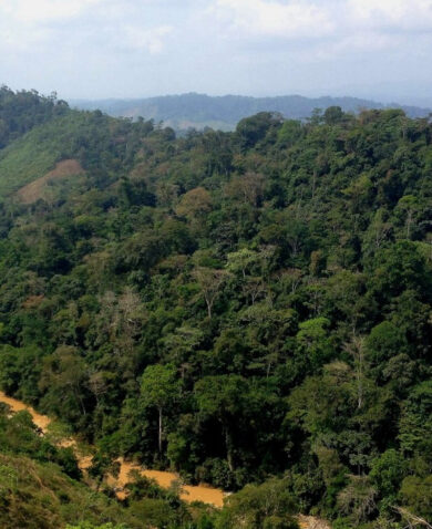
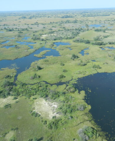
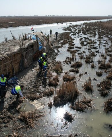
In the Okavango River Basin, one approach is doing just that. The Land-Use Conflict Identification Strategy, or LUCIS, is a geographic information system (GIS) model and decision-making approach developed by researchers at the University of Florida that reduces conflict by incorporating scientific analysis into an inclusive stakeholder-driven discussion about land use.
When the Permanent Okavango River Basin Water Commission (OKACOM) challenged USAID and Chemonics’ Southern African Regional Environmental Program (SAREP) to find areas for development that would have the least impact on the river system, maximize community-level livelihoods, and protected the wildlife in the world-famous Okavango river basin, SAREP turned to LUCIS.
Closing the science-policy gap
While initially designed for specific land-use alternatives in the United States, SAREP adapted the tool to the challenges and livelihoods decisions faced by the communities of the Okavango River Basin — the first use of the model in this context. Using this approach, SAREP launched a pilot program in 2012 in the Seronga sub-district of northern Botswana.
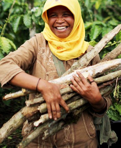
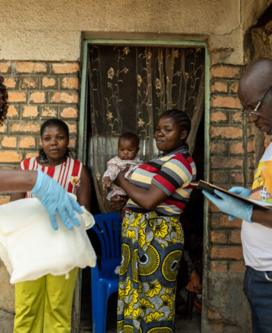
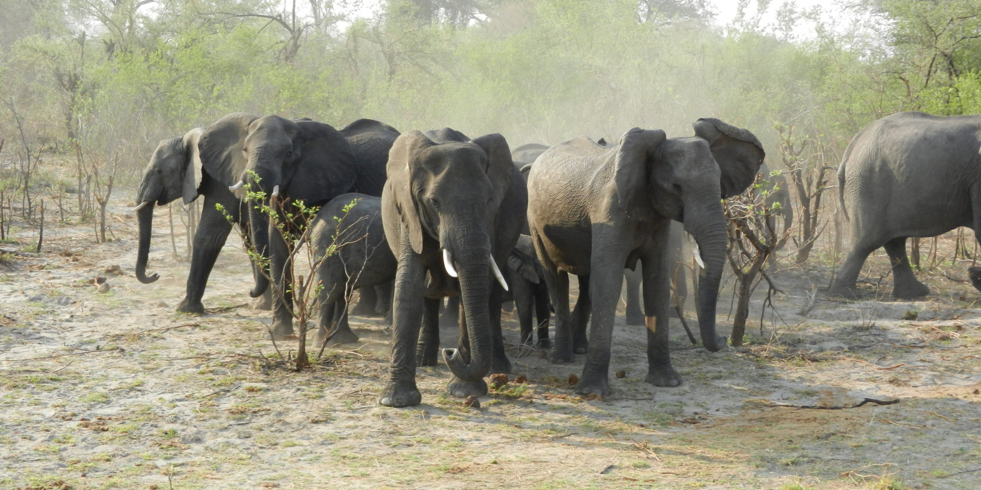
Farmers in the area know the costs of living with wildlife. Overnight a family’s crops can be decimated by the elephants that outnumber the people of the area. The location of a field can put livelihoods, and lives, at risk. Working closely with the land board, SAREP and local partner organization Ecoexist used LUCIS to help ensure that good land for agriculture was identified and allocated away from well-known elephant pathways to reduce human-elephant conflict and improve harvests.
At the same time, the program used the model to help local communities understand their options and develop plans that put their needs and preferences at the forefront. Following the successful application of the tool in Seronga, LUCIS was rolled out to the entire Ngamiland district in 2014 and is being considered for national rollout in Botswana.
LUCIS in five steps
- Define enhancing and constraining factors to determine land-use suitability. Land-use conflicts can lead to the sub-optimal use of land and eventually land degradation. SAREP analysed farming, pastoralism, and conservation (the three principle land uses in the area) to determine which factors facilitated and constrained land use for the activity, such as soil fertility, proximity to roads and settlements, and access to potable water.
- Inventory available data resources and apply the factors identified. Identifying these factors is only valuable if there is standardized information available on them. With the data available, a team of experts developed distance criteria for each factor to determine their relative level of influence. For example, the benefits of surface water vary if the water is 0 kilometers away or 6 kilometers, at which point it is too far for cattle to reach.
- Analyze data to determine and rank relative suitability of each land unit for each use. With the factors determined, and the data available, each unit of land is analysed to determine the overall suitability of the specific land-use activity. For example, existing soil types and identified elephant corridors are ranked for their influence on farming, as shown here.
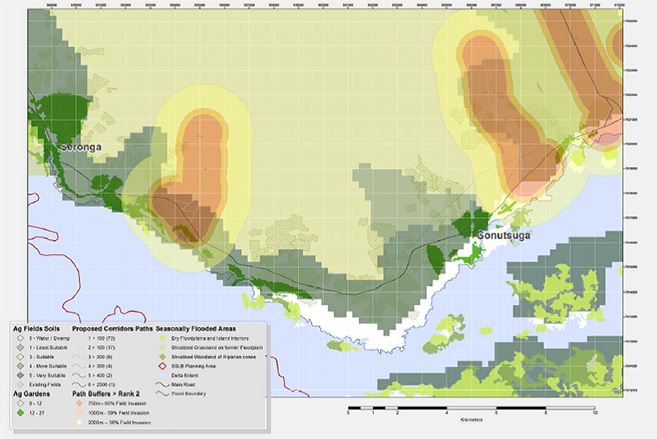
- Develop suitability maps for each land use and present to stakeholders to determine preference. While suitability looks at the potential of a piece of land for a particular use, preference looks at which use the stakeholders value the most. In the case of Seronga, suitability maps for each of the main land-use activities were developed and presented at a series of community meetings organized by the land board. At these meetings, community members discussed the issues of land use and conflict, and used a simple voting method (shown below) to register their preferred land use.

- Compare the ranges of land-use preference to determine likely areas of future land-use conflict. In the final step, the suitability maps were revised based on the communities’ feedback. For example, community members saw distance to the village as more important than the distance to the road, which had been previously identified by the expert team in Step 2. Revised maps are then combined to determine areas of conflict as well as areas with a clear best single use. Each conflict type was discussed at another series of community meetings to resolve and define relative land use preferences and to present them to the land boards.
More than a map
The GIS maps produced by the LUCIS tool provide communities with clear and useful information, but it is the inclusive and transparent process to produce the maps that has the greatest potential to reduce conflict. This process is crucial because decision-making at the local scale can have global consequences — especially in such an important spot as the Okavango Delta — and support tools need to be flexible and open to all interested and affected parties to achieve collaboration in implementation. The output from LUCIS is a model that can be updated as priorities and preferences change and as more data becomes available. In Seronga, SAREP is working with communities, the land board, and local partner organizations to bring the power of science-based tools to decision making to ensure people’s livelihoods and wildlife are protected in one of the world’s global treasures.

About Brian App
Brian App is an international natural resource management specialist with over 20 years of experience working in the climate and environmental sectors. Brian currently serves as a Senior Climate Services Director in Chemonics’ Climate Group where he helps identify and better understand climate risks and opportunities to improve climate integration into programs and proposals across…