Making the Last Mile Clearer than Ever
June 23, 2021 | 6 Minute ReadTo increase the end-to-end visibility of commodity location throughout distribution, the Global Health Supply Chain Program-Procurement Supply Management project in Cameroon, Haiti, and Niger began tracking last-mile distribution in January 2021 using global positioning system technology installed in third-party logistics vehicles.
In an effort to reduce malaria and HIV morbidity, and to improve access to maternal and child health and family planning commodities, the Global Health Supply Chain Program-Procurement Supply Management (GHSC-PSM) project delivers key life-saving medicines to the last mile across the world. Distribution of commodities in Cameroon, Haiti, and Niger is often inhibited by extreme weather conditions, political unrest, poor or nonexistent road conditions, crime, and the lack of a trained workforce. These complexities require creative problem-solving and forward-focused solutions to create a proactive, efficient supply chain. Tracking last-mile distribution (LMD) with real-time global positioning system (GPS) data has provided end-to-end visibility of movement of commodities and the data necessary to improve efficiency and address problems in real time.
Although each country faces unique challenges, by implementing the GPS tracking methodology concurrently, the three GHSC-PSM teams have collaborated, problem solved, and adapted to the new procedures more effectively and efficiently. In many countries, it is common for GPS tracking requirements to be added to third-party logistics (3PL) transportation requests for proposals and eventually flow to contracts. Adherence to this arrangement is inconsistent, however, and the project often underutilizes the software. Challenges — including using multiple platforms, acquiring usernames and passwords, ensuring that accounts are active and invoices are paid, and creating custom reports — lead to an inability to incorporate real-time tracking effectively and efficiently into standard management practices. Having one GPS tracking platform across the 3PL providers’ and Chemonics’ project vehicles in these countries streamlines and centralizes accurate and consistent tracking. The data collected provides insights into several areas for improvement:
- Limited documentation of the state/status of the roads and delivery routes
- Lack of oversight/visibility of commodities once they leave GHSC-PSM and partner warehouses
- Lack of understanding on timing and duration of commodity distribution
- Reduction in the duplication of efforts in commodity distribution
- Efficiency of distribution routes
- Evidence that can be used for root-cause analysis, process improvement, and policy compliance documentation
How is GPS Tracking Used?
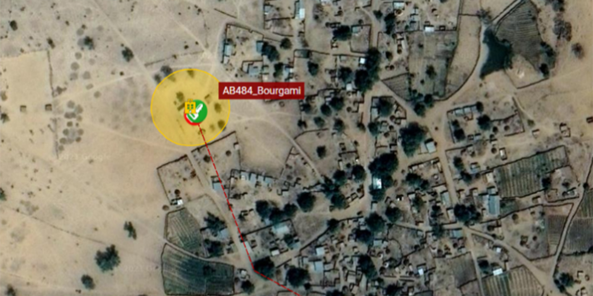
GHSC-PSM uses a series of online tools and applications centered around a U.S.-based GPS software and hardware company to create a system of distribution oversight, collect information on local geographic considerations, and share and review distribution practices. The GPS tracker technology allows users to create geofences around key locations, such as health facilities, and to view the locations of vehicles/trackers on a map. Staff receive email alerts for movement — starting, stopping, and entering/exiting geofences — that allow them to confirm a vehicle’s location in relation to the facilities on a delivery route at any moment. To accurately track deliveries, the first step in this initiative was to collect and map GPS locations, because most of the GPS location data was outdated or incorrect. This process varied between regions and countries. Where appropriate, the project sent teams to conduct a site-level survey, noting their GPS location, the facility name, and other information. In other instances, facility or project staff sent their location as “pin drops” through Android applications such as WhatsApp. When these options, as well as staff experience at the sites, were not possible or sufficient to verify a location, staff used the GPS tracking software to obtain GPS coordinates. The location was verified when the driver notified staff from a site; project staff cross-referenced that location with Google Maps. Across the three countries, the project now tracks LMD in real time to more than 1,000 facilities (Cameroon: 290+; Haiti: 270+; Niger: 500+).

Insights from GPS Tracking
The increased visibility has allowed the project to identify aspects of the distribution cycle that lacked oversight, including drivers completing deliveries outside the approved delivery window and quick deliveries that are not reviewed for accuracy or completeness. The project has identified deliveries in the early morning (e.g., 6 a.m.) and late evening (e.g., 9 p.m.). These unauthorized delivery times increase the risk of commodity diversion because the commodities may be left unattended, or the facility may not complete the quality and quantity reviews. It is also possible that facilities are pressured and intimidated to accept deliveries outside working hours. By receiving alerts in real time, project staff can follow up with 3PL companies and their drivers to ensure immediate action and future compliance. Deliveries must be reviewed for condition and contents by a qualified staff member, and the proof of delivery must be signed before the driver leaves the facility because the cause of missing commodities cannot be identified and addressed if this review is not completed accurately. By comparing the enter and exit alerts to the list of delivered contents and following up with facilities, the project has found that some deliveries require more time for review than the driver allows. Accurate proof of delivery documents are required for possible audits and to identify the root cause of potential incidents. The project communicates driver policy deviation to improve compliance and to provide 3PL management with information on drivers’ productivity, building the project’s relationship with 3PLs.
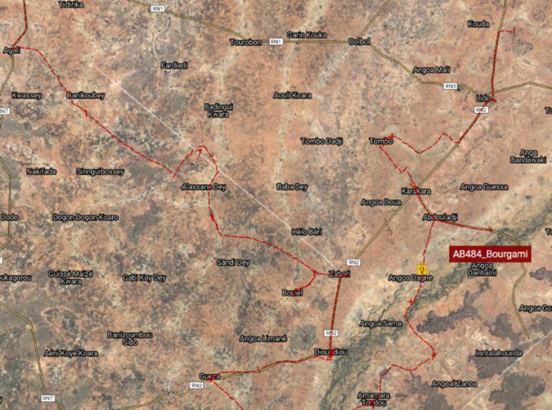
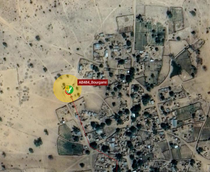
Accurate distribution data allows the project to identify areas for distribution plan efficiencies. Real-time data from the GPS trackers provides the exact time and distance for any route between sites. The data accounts for poor road conditions that are not available on maps. This has allowed the project in Cameroon to map the most efficient distribution routes across 10 regions, reducing time and cost for the project and the 3PL. In Niger, 3PLs often request 14 days to complete one round of regional distribution (218 sites in Tahoua). After three full distribution cycles, however, an analysis of GPS data demonstrated that an average of only nine days is required to complete distribution across Tahoua and Dosso (371 sites). These and other insights help GHSC-PSM plan for distributions, improve technical assistance to government counterparts, and reduce unnecessary costs — including payment for additional vehicles, per diem for travel days, and reorders and delivery of missing commodities.
Benefits of LMD Tracking Using GPS Technology
The GPS trackers and associated technology have proven successful in improving data visibility, managing risk, and identifying capacity building opportunities for Ministry of Health staff and the private sector. The data reduces ambiguity for stakeholders, identifies data gaps and inconsistencies, and provides insights to improve distribution. The strengthening of these processes also improves risk management oversight, including the reduction of commodity diversion. Distribution and 3PL personnel are key to implementing this strategy. Collaborating to improve and implement strategies builds relationships, as well as internal and private sector capacity. Not only is GHSC-PSM better able to work with government partners to improve distribution practices, but the 3PLs are also improving their own capacity to carry out deliveries that consistently meet the standards of the GHSC-PSM project.
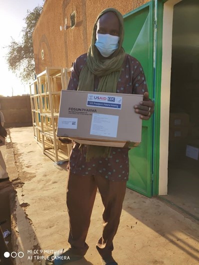
This initiative is transitioning from pilot to scale phase in Cameroon, Haiti, and Niger. Because each country has its own challenges, each country’s GPS tracking implementation is at a different stage. The project will continue to monitor and use real-time data for decision-making to develop the most efficient distribution routes, understand delays and areas for improvement, and communicate findings with 3PL providers. This visibility and the process improvements it facilitates help ensure that beneficiaries receive the lifesaving medicines they require.
Posts on the blog represent the views of the authors and do not necessarily represent the views of Chemonics.

